“False Spring” Is Heating Up the U.S., But Get Ready for Winter’s Brutal Comeback

Mitja Mithans / Shutterstock
We’ve been hit with several storms and arctic blasts this winter, but we’ve also experienced some intermittent relief and above-average temperatures. Right now, those climbing temps have many Americans feeling like it’s already well past February. But while you might be spending more time outside and enjoying the “false spring,” be prepared to bundle up again, because winter will be returning with a vengeance. Read on to find out when you’ll need to crank the heat again.
RELATED: Winter Storm Could Bring More Than 10 Inches of Snow to These Regions .

janniwet/Shutterstock
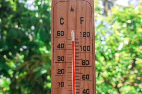
While “the calendar says February,” it has felt “ more like April ” across Central and Eastern U.S. this week, AccuWeather meteorologist Alyssa Glenny wrote on Feb. 5.
On Tuesday, Feb. 6, temperatures in some areas were almost double the historical average—in Minneapolis, it reached a shocking 57 degrees. The surprising high beat the previous record of 51 degrees, which hasn’t been topped in 99 years, WCCO News reported. In early February, the average high in the Twin Cities is only 25 degrees, USA Today reported.
Additionally, those in the Northeast and the Great Lakes were “basking in the sunshine” over the weekend through Monday and Tuesday, according to Accuweather meteorologist Dean DeVore . But for the remainder of this week, warmer temperatures are likely to shift north and east.
Those in the Plains and the Northeast should notice somewhere between a 5- to 15-degree shift today and then again from Sunday to Monday, per AccuWeather. Today or tomorrow, temperatures in the Central and Southern Plains—like Little Rock Arkansas; Shreveport, Louisiana; and Dallas—may even see the high 70s.
RELATED: “Polar Vortex Disruption” Will Send U.S. Temps Plummeting—Here’s When .
scorpeow / Shutterstock
The National Weather Service (NWS) Prediction Center notes that “ much above average temperatures ” will continue through the end of the work week for the Central and Eastern U.S., with record warmth slated for locations in the Great Lakes and the Mid-Atlantic.
Through Saturday, highs in the 40s and 50s are predicted for the Upper Midwest and the Great Lakes, while the Middle Mississippi Valley may see temps in the 50s, which is upwards of 25 to 35 degrees above average, the NWS notes. In the South, from the Southern Plains into the Southeast, highs will be somewhere in the 60s and 70s.
As AccuWeather senior meteorologist Bob Larson told USA Today , we have the jet stream to thank for these spring-like temperatures. Because of where it’s positioned right now, it’s moving mild air to the Central and Eastern U.S., he said. The jet stream’s strength is also keeping colder air in Canada as opposed to moving it south to the U.S.
RELATED: “Extended Winter” May Keep Things Cold in These Regions, Meteorologists Predict .
iStock
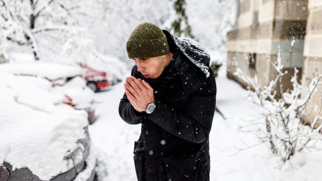
While warmer temperatures are a nice reprieve from cold and snow, it’s not going to last forever: Wintry weather will soon be returning to certain regions.
The jet stream is set to reposition, Larson told USA Today , and temperatures will drop as a result. The Central and Eastern U.S. will feel colder air from Canada, and snow is also a possibility in the Northeast, he said. Extreme cold and storms are also likely by the end of next week.
“A ‘word to the wise,’ enjoy the next 10 days or so, because some winter cold and winter-type weather will likely come back into play for the eastern U.S. prior to and even beyond Valentine’s Day for the second half of February,” DeVore said, per USA Today.

Paolo Cordoni/iStock
Making things a bit more complicated, a “polar vortex disruption” could also affect weather across the U.S. Judah Cohen , director of seasonal forecasting for Verisk Atmospheric and Environmental Research, says that changes with the vortex are slated for mid-February.
As of Feb. 5, the latest near-term outlook showed an elongation of the vortex around Feb. 15. Just a few days later, it could split, change its trajectory, and send colder air down to the northern U.S. A temperature forecast map suggests people in the Midwest, Northeast, and northern areas of the Southeast could see temperatures around 5 degrees colder than usual between Feb. 16 and 20, meaning many areas may be well below freezing.
Echoing Cohen’s predictions, Fox Weather meteorologist Britta Merwin reiterated in a Feb. 2 segment that “we have a little more winter weather to get through.”
She, too, pointed to a computer model that anticipates a mid-month temperature drop due to the polar vortex disruption.
“It means that arctic air is going to break away from the poles and move into the northern part of the U.S.,” Merwin said. “This is what’s key for winter weather across areas like the Great Lakes in the Northeast. We have to have that arctic air move into the country for us to get big snowstorms.”
- Source: NWS: Weather Prediction Center
“Arctic Blast” and Widespread Snow Predicted for Next Month—Here’s Where
ProfessionalStudioImages/iStock
The kickoff to 2024 has served as a reminder of just how severe winter weather can get. From freezing temperatures to devastating flooding , few regions have been spared since January began. But with several weeks to go before spring kicks in, meteorologists have already predicted there could be another “arctic blast” and more widespread snow next month. Read on to see why conditions could get so extreme in February and what regions the weather could affect the most.
RELATED: Polar Vortex Could Bring “Severe Winter Weather” to the U.S.—Here’s When .

iStock
The frigid temperatures that swept across the nation earlier this month were a jolting reminder that winter had arrived. However, the colder-than-usual conditions were actually the result of a weather pattern known as the “polar vortex.”
The term refers to a counterclockwise flow of air that keeps a block of low pressure and cold air at the planet’s poles in place, according to the National Oceanic and Atmospheric Administration’s (NOAA) National Weather Service (NWS). Occasionally, it descends into the continental U.S.—and meteorologists say this explains why so many regions woke up to freezing conditions earlier this month.
“It appears as though the minor [vortex] warming during the first week of January and the subsequent destruction of the polar vortex in the lower stratosphere were enough to at least help set the stage for the cold air outbreak over North America this past weekend,” Climate.gov wrote.
RELATED: Weather Predictions Keep Changing—What the Unpredictable Shifts Mean for You .
iStock
Even as last week’s cold snaps have reversed course into some unseasonably warm weather , it’s unlikely we’ve seen the last arctic blast of the winter . According to a blog post by Judah Cohen , an atmospheric scientist and director of seasonal forecasting at Atmospheric and Environmental Research (AER), the polar vortex is a “rapidly transitioning situation” that will “come down to rinse, lather, repeat.”
Cohen explained his reasoning during an interview with Fox Weather on Jan. 23, where he also outlined how he believes the forecast will play out in the coming weeks. However, the next cold wave might start off with the opposite weather you expect.
“For the first half of January, that polar vortex kind of stumbled and fell foul there, moved south. We had the arctic outbreak,” Cohen told the network. “But now it’s, it’s back together, let’s say, and, it’s a very tight spin, rotation of the polar vortex. All the cold air is receding back towards the North Pole, and we’re going to have a milder end of the month of January.”
RELATED: 7 Ways to Winter-Proof Your Car, According to Experts .

iStock
However, the rising mercury may end up being a red herring for what’s to come.
“We’re probably going to see a record warm, like we had that happen in December,” Cohen told Fox Weather in his near-term prediction. “But I do think then, often when you have these Canadian warmings, the polar vortex then tends to transition into a very large disruption called a sudden stratospheric warming or a stretching event, like a rubber band (pulling cold air south).”
Cohen told the network that these very conditions are what created this month’s frigid conditions, and he believes there’s a “good chance” it will repeat itself next month.
“I think in the time frame of the second week of February and even possibly mid-February a stretched polar vortex is becoming more likely,” he told Fox Weather. “This should help end the very mild pattern in place across North America. The intensity and duration of cold weather associated with the stretched polar vortex is yet to be determined.”
Damian Lugowski / Shutterstock
Dealing with another blast of freezing temperatures may be par for the course as far as winter is concerned. But Cohen also says some regions could see more snow and extreme weather head their way as another variable affects conditions.
Weather forecasts still consider the effects of El Niño in the winter, which describes a patch of warmer-than-average water off the coast of South America. Typically, it generates wetter weather in the West while bringing more mild, less snowy conditions to the East Coast, according to National Geographic . But as the season progresses, the weakening warmth could bring about a drastic change on top of the polar vortex.
“As far as El Niño, I do think that less than strong is better for snow and cold in the East,” Cohen told The Washington Post in an email.
Altogether, Cohen believes those who are hoping for an early start to spring will be disappointed by what’s likely coming. “I don’t think it’s the end of winter,” he told Fox Weather. “I think it’s not a breakdown of the pattern, but I think a relaxing pattern.”
- Source: NWS: What Is the Polar Vortex?
- Source: NOAA Climate.gov: The polar vortex is acting up
