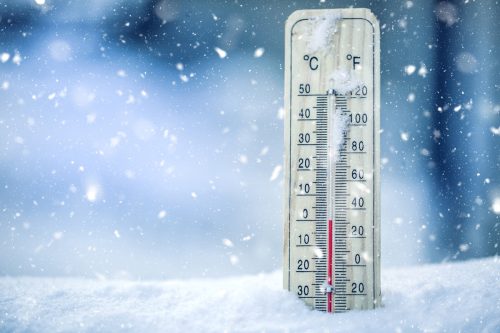
“Remarkable” Polar Vortex Disruptions Could Send Temps Plummeting Again—Here’s When

iStock
Despite what a groundhog might have led you to believe, the early spring we’ve been anticipating might look a little more complicated than expected. Even with warmer weather very much on the horizon, some experts are now warning that the polar vortex could once again shake things up before winter officially ends. Read on to find out more about the “remarkable” polar vortex disruptions that could send temps plummeting, and when you’ll have to bundle up once more.
RELATED: This Week’s Winter Storm Could Bring Even More Snow to These Regions .

iStock
Hoping for warm weather next month? You may be out of luck. New weather models indicate that disruptions of the polar vortex could put some of the U.S. back into wintry weather around mid-March, The Washington Post reported.
These models show that the vortex will abruptly weaken or collapse in about two weeks—a disruption that Judah Cohen , long-range forecaster at Verisk Atmospheric and Environmental Research, told the newspaper will be “fairly large.”
This is something many experts weren’t anticipating, as we already saw one polar vortex disruption back in January.
“What is remarkable is we have a second disruption to the stratospheric vortex happening right now,” Andrea Lang , PhD, a professor of atmospheric sciences at the University of Wisconsin at Madison, told WaPo . “Two major disruptions to the polar vortex in one season is not common. It has happened before, but it is not something that you expect to happen in any given winter season.”
RELATED: New Spring Forecast Shows Which U.S. Regions Will Be Warmer and Wetter This Year .

Paolo Cordoni/iStock
The disruptions will potentially displace cold air due to a change in Arctic Oscillation (AO), which is a natural climate pattern that affects how the polar vortex is configured, according to the National Snow and Ice Data Center (NSIDC). When the AO is positive, the polar vortex’s cold air tends to remain toward the north. The negative phase of AO pushes it farther south, however.
Long-range weather models currently suggest that the AO will turn negative sometime around March 7, which is likely to set off one to two weeks of cold, stormy weather for those east of the Rocky Mountains during the middle of next month, WaPo reported.
“That would put a return of colder weather [for the Eastern U.S.] in mid-March,” Cohen confirmed.
RELATED: “Extended Winter” May Keep Things Cold in These Regions, Meteorologists Predict .

PeopleImages.com – Yuri A / Shutterstock
If you live in the eastern part of the U.S., you might get hit with warmer weather before the polar vortex disruptions. During the last week of February, an area of the country stretching from Dallas north to Minneapolis and east to Philadelphia is likely to see temperatures that are more common in May or June, CNN reported.
According to the news outlet, the warmth is expected to reach the East Coast by Feb. 28—bringing highs in the 60s for cities like Philadelphia and New York. But milder-than-average temperatures in the eastern U.S. during the lead-up to the polar vortex disruption are expected and “consistent with the weather model forecasts,” Cohen told WaPo .
“A major sudden stratospheric warming is likely to occur during the first week of March,” Simon Lee , a research scientist at Columbia University, explained to the newspaper. “These events do, on average, bring about a negative Arctic Oscillation pattern at the surface.”
iStock
Don’t let the warmth fool you. Cohen reiterated that the Eastern U.S. is still expected to turn colder after the stratospheric warming—about two weeks after.
The warmer-than-average temperatures at the beginning of the month may even be more deceptive if the polar vortex becomes stretched out during the sudden stratospheric warming. If that occurs, the stretch vortex could react like a rubber band and snap, sending temperatures plummeting farther and sooner than expected, Cohen explained.
“That can result in a quicker return of colder air to the Eastern U.S. and more intense cold,” the forecaster said. “This is something that I am watching but for now I don’t see any signs of it in the weather models. If we do get a stretched polar vortex that piggybacks on the [sudden stratospheric warming], then colder weather can return to the Eastern U.S. sometime during the first two weeks of March.”
- Source: NSIDC: What is the polar vortex?
Above-Average Temps Warming Entire U.S. Next Week—How It’ll Affect Your Region

iStock
Most of the U.S. has been huddled under blankets amid frigid temperatures this week. If you’re already sick of all the snow, ice, and arctic air, you may be in luck. A major weather pattern change is expected to reverse trends next week, according to the National Weather Service’s (NWS) Climate Prediction Center (CPC). The CPC just issued its latest temperature outlook , predicting that above-average temps will be warming the entire country through the end of the month. Read on to find out more about how this “transition to a warmer pattern” will affect your region.
RELATED: Winter Storm Bringing Another 8 Inches of Snow to These Regions .

bodnar.photo / Shutterstock
This new warming trend is expected to begin as early as Jan. 21 in parts of the West, CNN reported. By the last week of January, the CPC predicts that most of this region will have a 60 to 80 percent chance of experiencing above-average temperatures.
But that doesn’t mean you’ll be staying dry. The warmer conditions arrive along with storm systems hitting the West next week, which is expected to bring higher rain levels to states like California, according to The Weather Channel. The highest elevations will also see increased snowfall.
RELATED: Why You Should Never Use Your GPS During a Snowstorm, Officials Warn .
Shutterstock
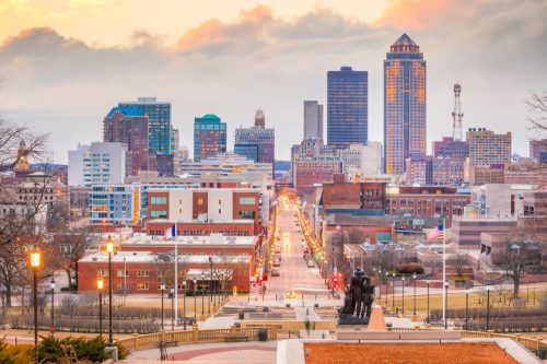
The most dramatic temperature changes are likely to hit midweek throughout the central part of the country, according to CNN. Some areas in the Midwest are expected to shift from temperatures that were 30 to 40 degrees below average last Sunday to temperatures that are 10 to 20 degrees above average by Jan. 24.
Cities such as Des Moines, Iowa, and Minneapolis, Minnesota, are set to see 40- to 50-degree temperature swings‚ making things feel much more like March than like January.
RELATED: Weather Predictions Keep Changing—What the Unpredictable Shifts Mean for You .

Shutterstock
Another blast of cold air is expected to hit the East Coast this weekend. But by early next week, freezing temperatures will have already started to thaw in the South, according to The Weather Channel.
This region is likely to see highs in the 50 and 60s on Monday and Tuesday. Then by mid-week, much of the South will be back in the 60s and 70s.

iStock
The Northeast is not going to be left out of this warming trend. By the middle of next week, highs in the 40s are expected to be common in places such as Indianapolis, Cleveland, Philadelphia, and New York City, according to CNN.
This will make the region feel like it’s in late February rather than the last weeks of January.
- Source: CPC: 8-14 Day Temperature Outlook
